Antarctica Part III –
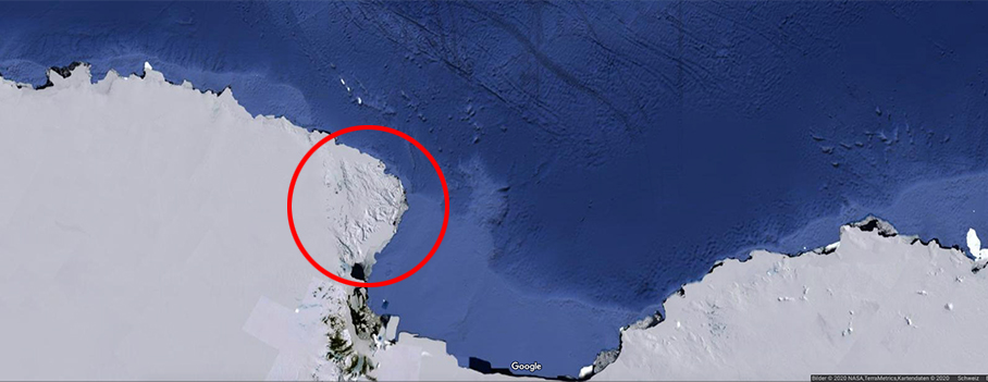
Cape Adare |
|
 |
|
 |
|
 |
|
Franklin Island is an island 13 kilometres long, lying in the Ross Sea about 130 kilometres east of Cape Hickey, Victoria Land. It was discovered on January 27, 1841 by James Clark Ross, and named for Sir John Franklin, the noted Arctic explorer and Governor of Van Diemen's Land (Tasmania). Freshwater Ecoregion of the World : unassigned |
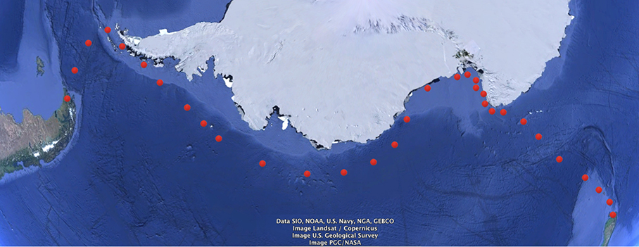
Produced in 2017. Red dots  indicate personal favorites. indicate personal favorites. |
|||
| Franklin Island | |
 |
 |
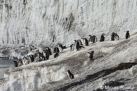
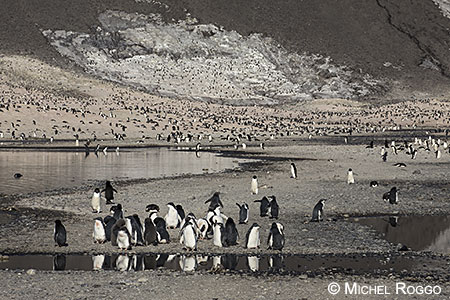
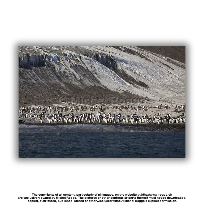 U40-701 Colony of Adélie penguin Franklin Island |
 U40-702 Colony of Adélie penguin Franklin Island |
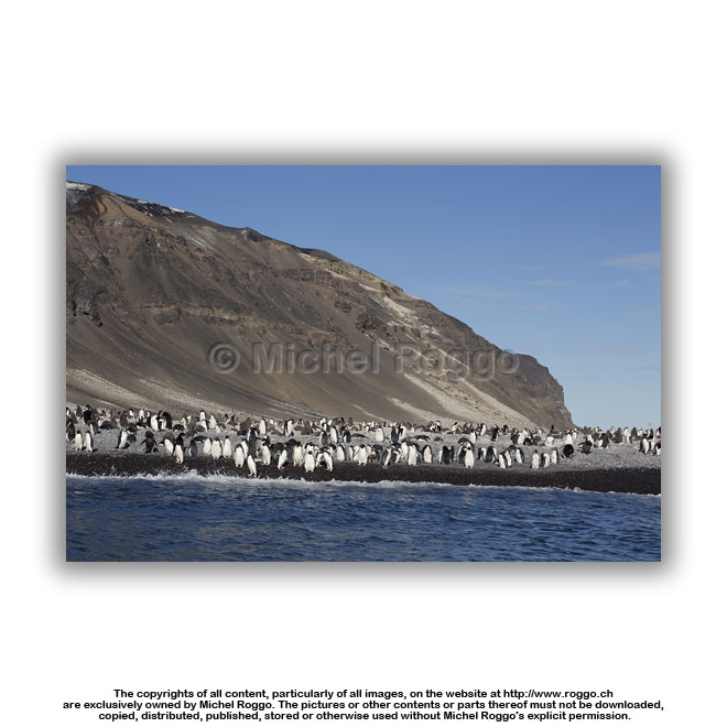 U40-703 Colony of Adélie penguin U40-703 Colony of Adélie penguinFranklin Island |
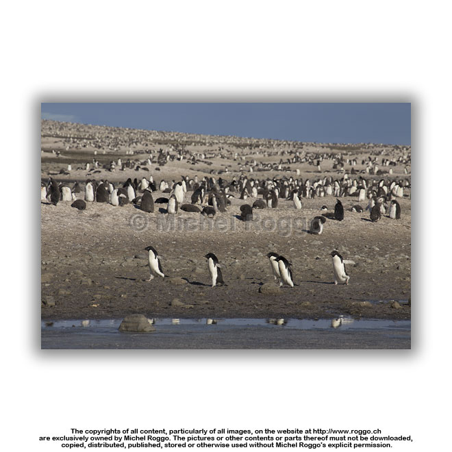 U40-704 Colony of Adélie penguin Franklin Island |
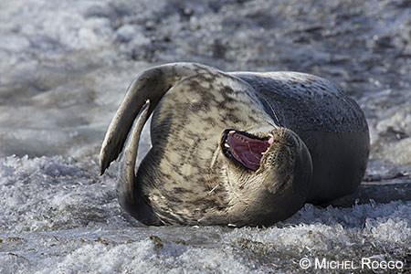
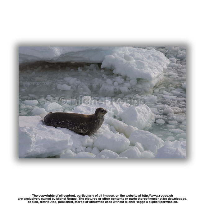
 U40-706 Weddell seal U40-706 Weddell sealFranklin Island |
 U40-707 Colony of Adélie penguin U40-707 Colony of Adélie penguinFranklin Island |
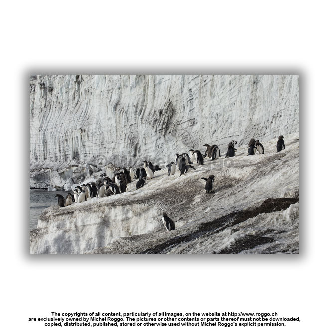 U40-708 Colony of Adélie penguin U40-708 Colony of Adélie penguinFranklin Island |
 U40-710 Colony of Adélie penguin U40-710 Colony of Adélie penguinFranklin Island |
| Terra Nova Bay | |||
 |
 |
||
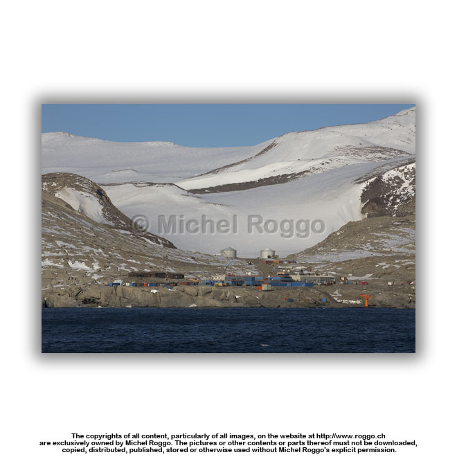 U40-711 Mario Zuchelli Station Terra Nova bay |
 U40-712
Terra Nova bay U40-712
Terra Nova bay |
 U40-713 Terra Nova bay |
 U40-714
Terra Nova bay U40-714
Terra Nova bay |
 U40-715 Terra Nova bay |
 U40-716 Terra Nova bay |
 U40-717 Terra Nova bay |
 U40-718
Terra Nova bay U40-718
Terra Nova bay |
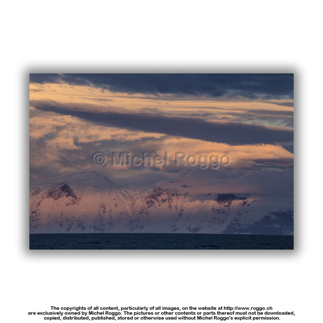
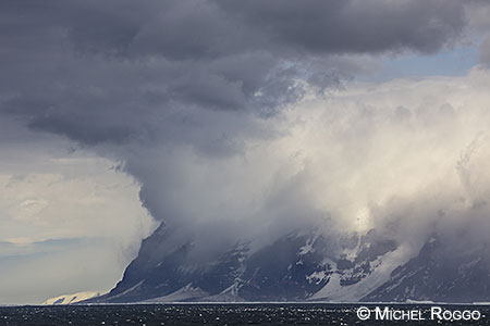
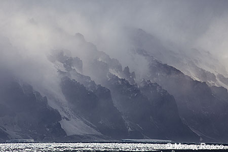
| Cape Hallett | |||
 |
 |
||
 |
 |
||
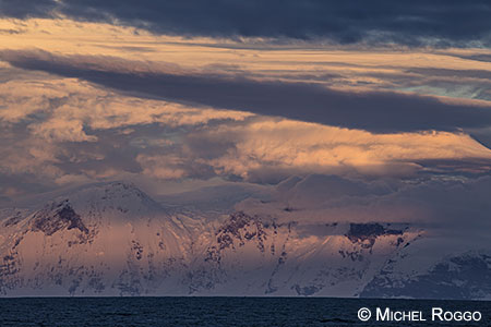
 U40-719 Katabatic wind U40-719 Katabatic windCape Hallett |
 U40-720 Katabatic wind Cape Hallett |
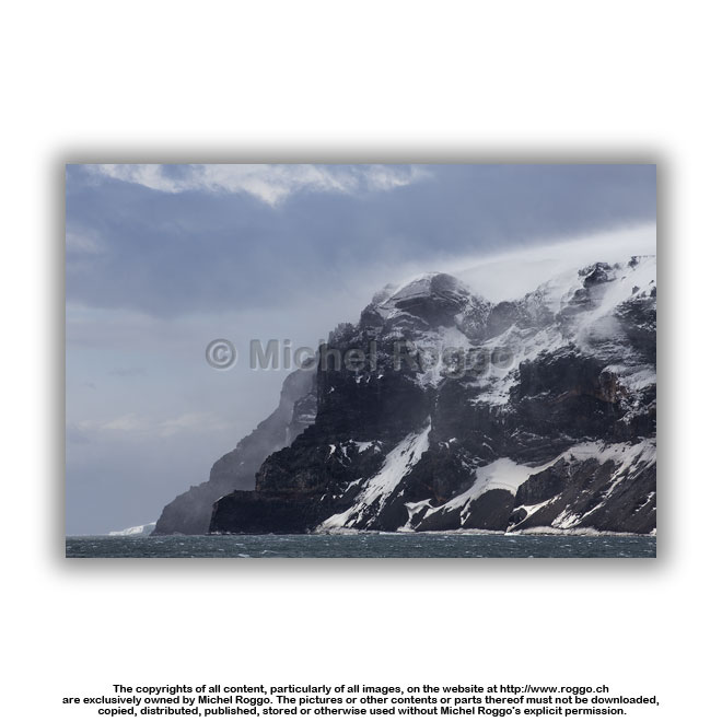 U40-721 Katabatic wind Cape Hallett |
 U40-722 Katabatic wind Cape Hallett |
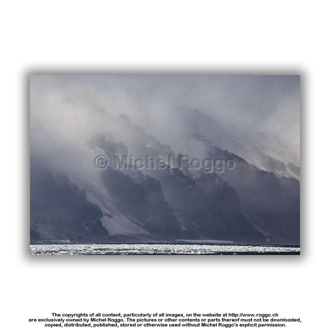 U40-723 Katabatic wind U40-723 Katabatic windCape Hallett |
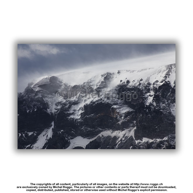
 U40-724 Cape Hallett U40-724 Cape Hallett |
 U40-725 Cape Hallett |
 U40-726 Cape Hallett |
 U40-727 Cape Hallett |
 U40-728 Cape Hallett |
 U40-729 Cape Hallett U40-729 Cape Hallett |
 U40-730 Cape Hallett |
 U40-731 Cape Hallett |
 U40-732 Cape Hallett |
 U40-733 Cape Hallett U40-733 Cape Hallett |
 U40-734 Cape Hallett U40-734 Cape Hallett |
 |
 |
||
 U40-735 Cape Hallett |
 U40-736 Cape Hallett U40-736 Cape Hallett |
 U40-737 Cape Hallett |
 U40-738 Cape Hallett |
 U40-739 Cape Hallett |
 U40-740 Cape Hallett U40-740 Cape Hallett |
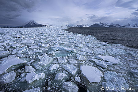
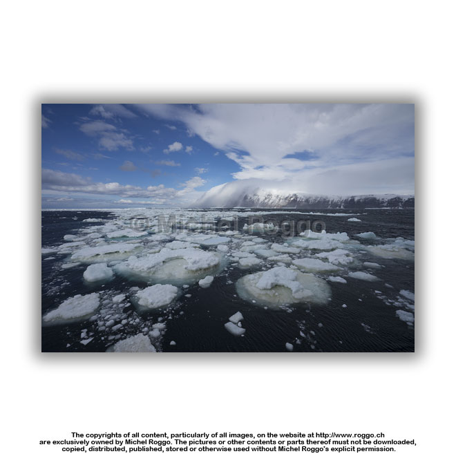 U40-743 Sea ice, Cape Hallett U40-743 Sea ice, Cape Hallett |
 U40-744 Sea ice, Cape Hallett U40-744 Sea ice, Cape Hallett |
 U40-745 Sea ice, Cape Hallett |
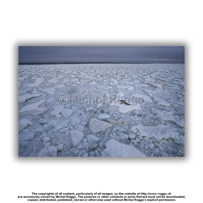 U40-746 Crabeater Seal on sea ice U40-746 Crabeater Seal on sea iceCape Hallett |
 U40-747 Crabeater Seal on sea ice Cape Hallett |
 U40-748 Weddell seal on sea ice U40-748 Weddell seal on sea iceCape Hallett |
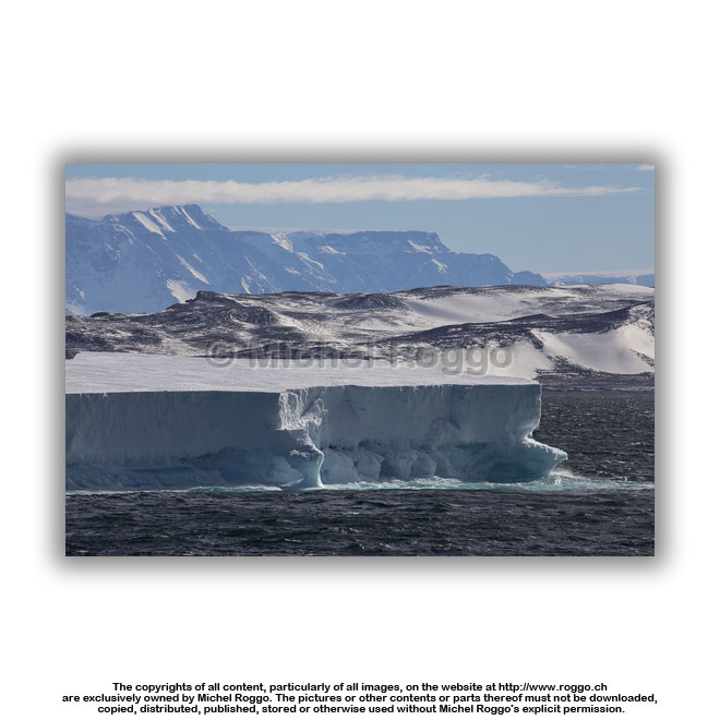
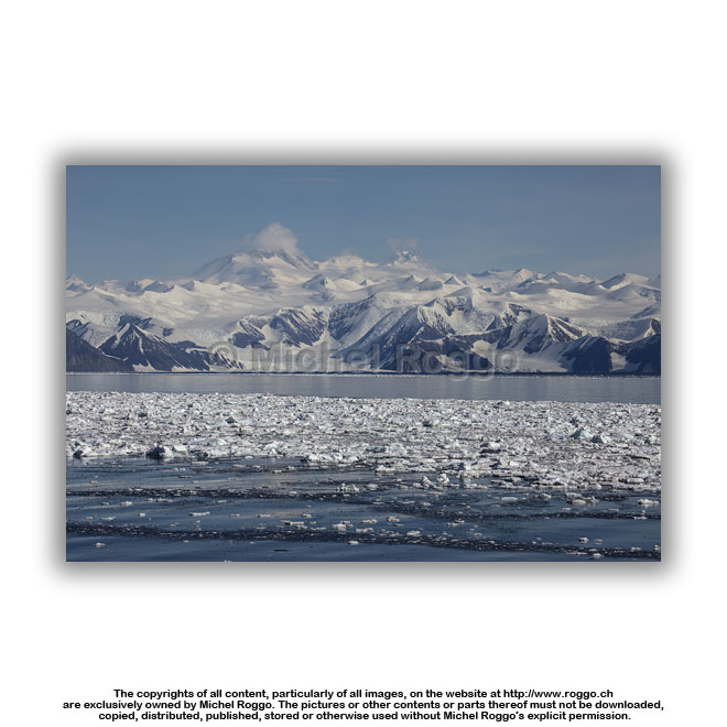
| Possession Islands | |||
 |
 |
||
|
|
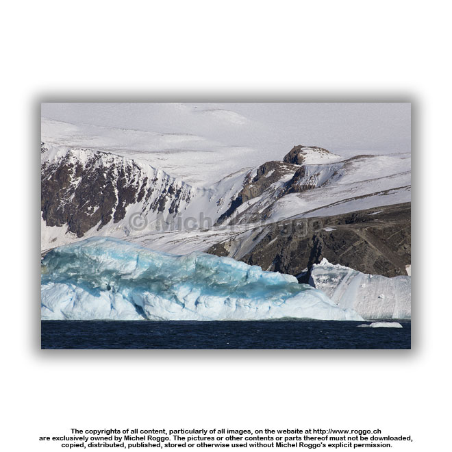
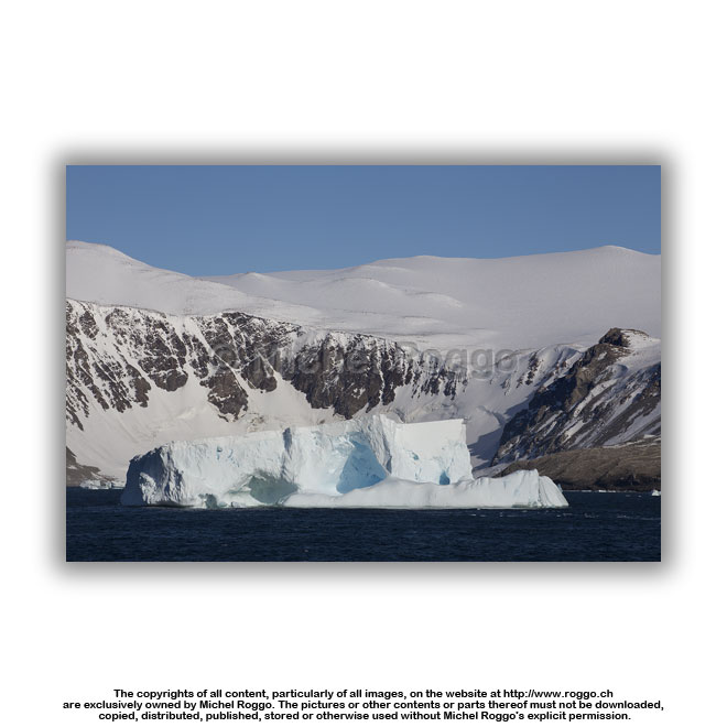
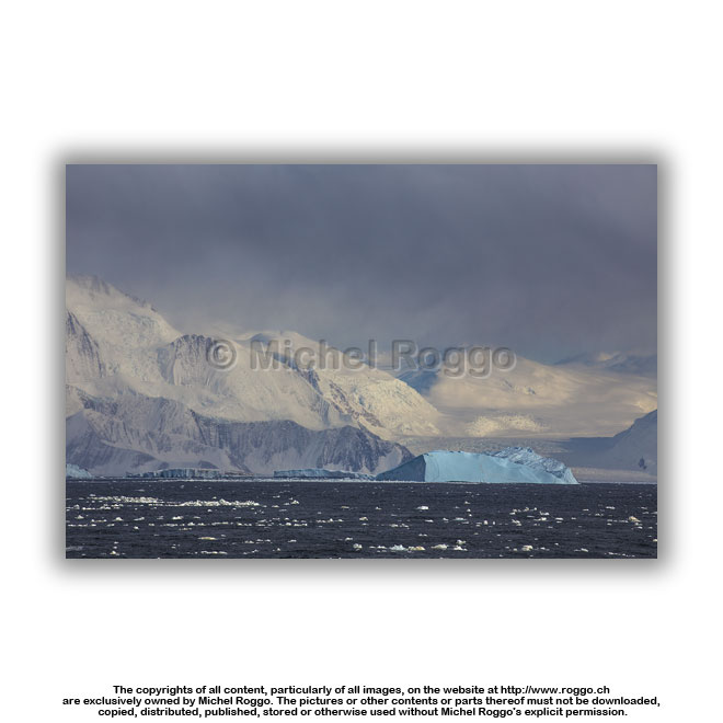
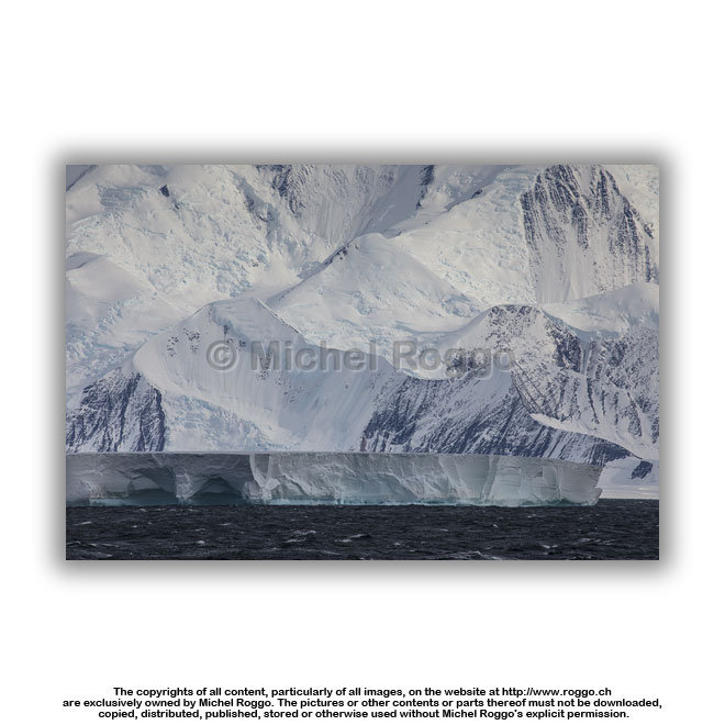
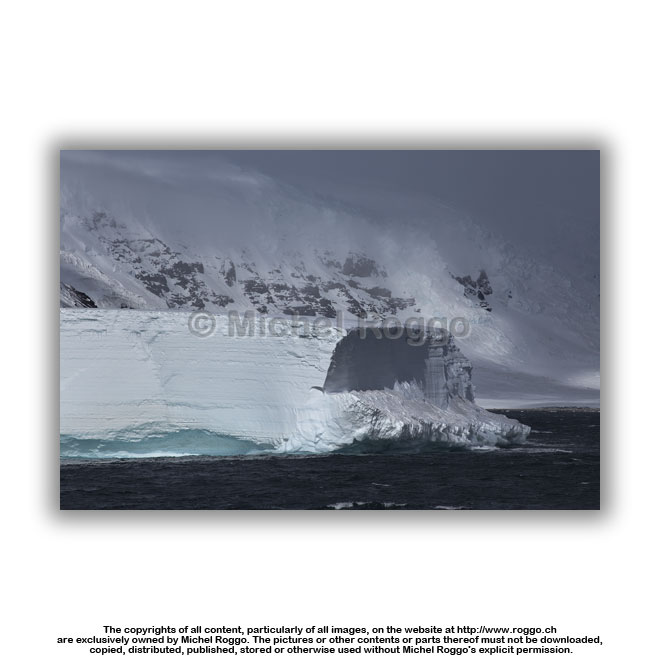
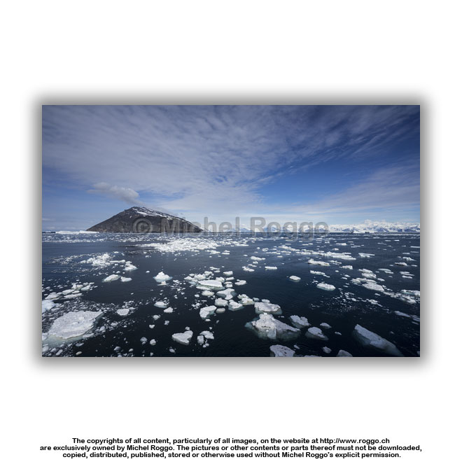
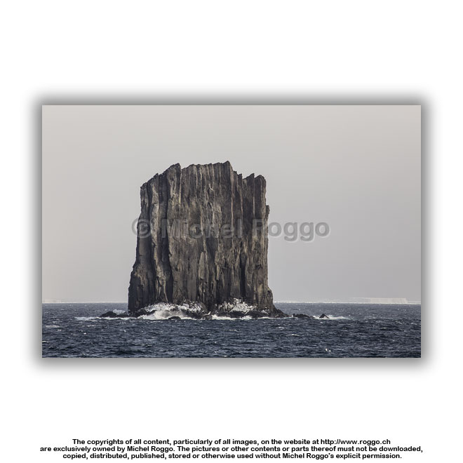
 U40-751 Icebergs Possession Islands |
 U40-753 Icebergs Possession Islands |
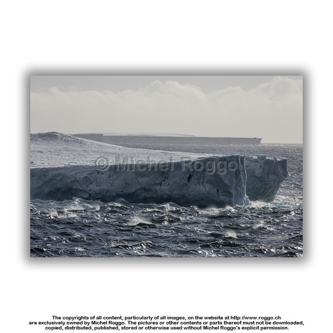 U40-754 Icebergs U40-754 IcebergsPossession Islands |
 U40-755 Icebergs Possession Islands |
 U40-756 Icebergs U40-756 IcebergsPossession Islands |
 U40-757 Icebergs Possession Islands |
 U40-758 Icebergs Possession Islands |
 U40-759 Icebergs Possession Islands |
 U40-760 Icebergs U40-760 IcebergsPossession Islands |
 U40-761 Icebergs Possession Islands |
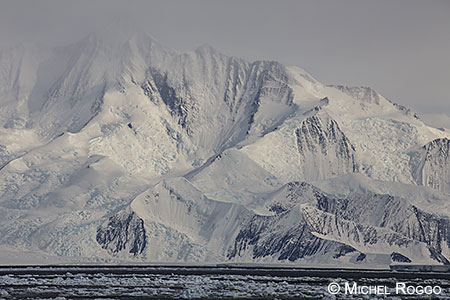
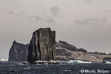
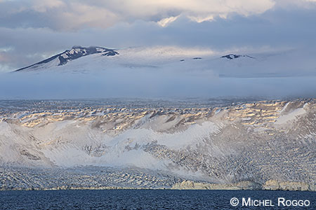
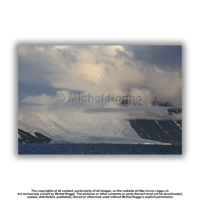
| Cape Adare | |||
 |
 |
||
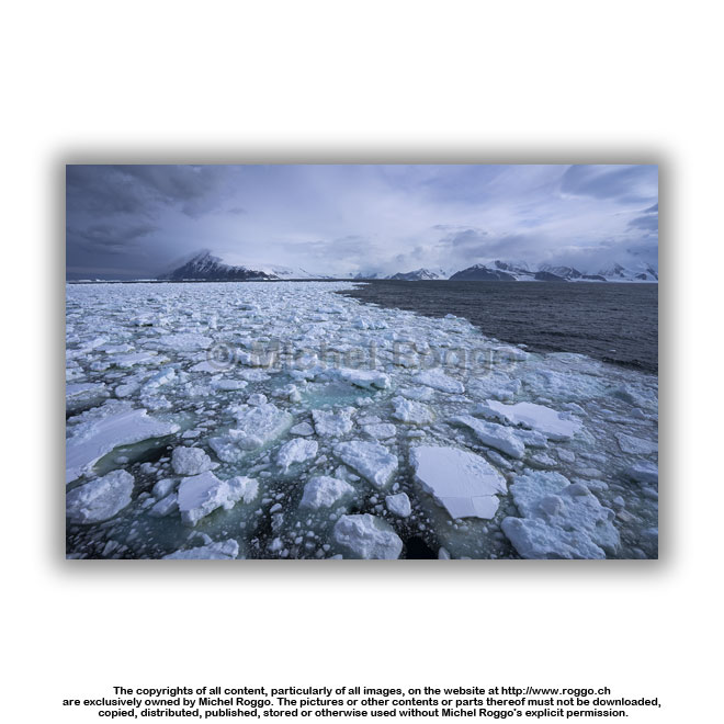
 U40-763 Sea ice U40-763 Sea iceCape Adare |
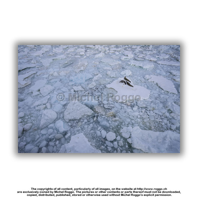
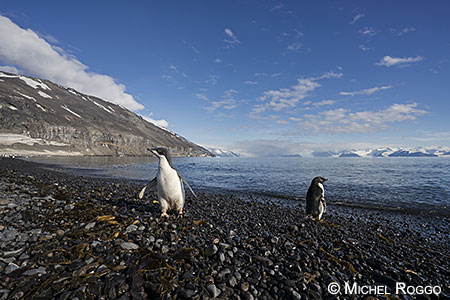
 U40-765 Adélie penguin on ice floe Cape Adare |
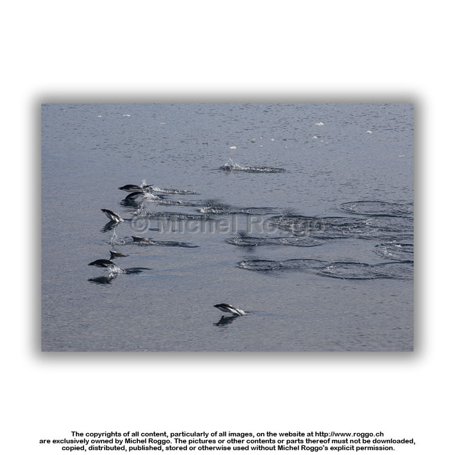 U40-767 Adélie penguin porpoising Cape Adare |
 U40-768 Adélie penguin U40-768 Adélie penguinCape Adare |
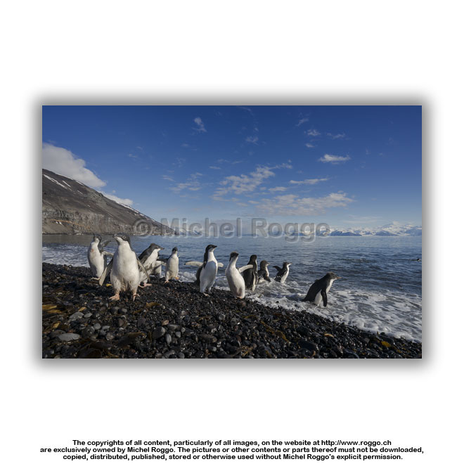 U40-769 Adélie penguin Cape Adare |
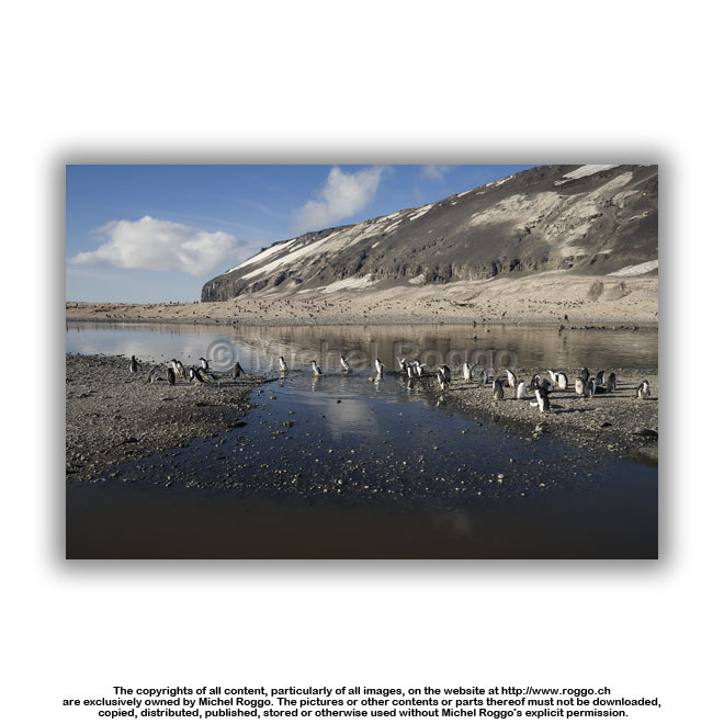 U40-770 Adélie penguin rookery meltwater pond, Cape Adare |
 U40-772 Adélie penguin rookery meltwater pond, Cape Adare |
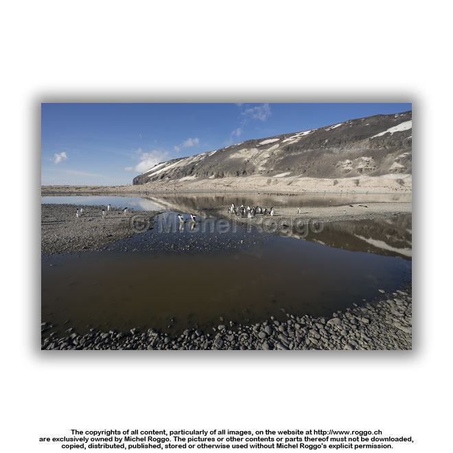
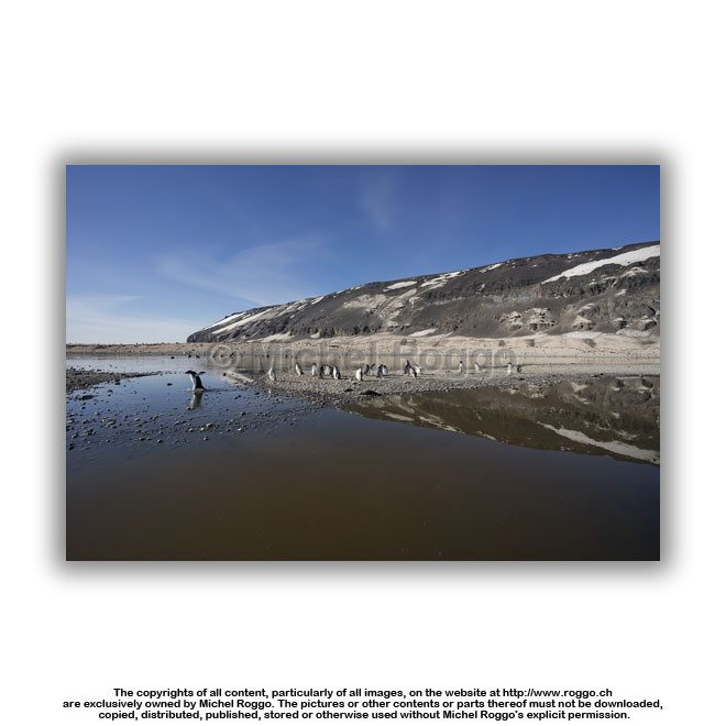 U40-773 Adélie penguin rookery U40-773 Adélie penguin rookerymeltwater pond, Cape Adare |
 U40-774 Adélie penguin rookery meltwater pond, Cape Adare |
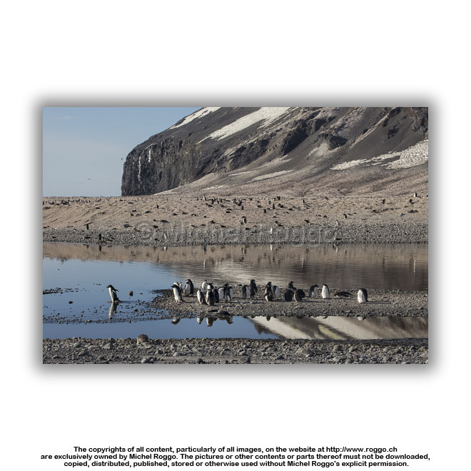 U40-775 Adélie penguin rookery meltwater pond, Cape Adare |
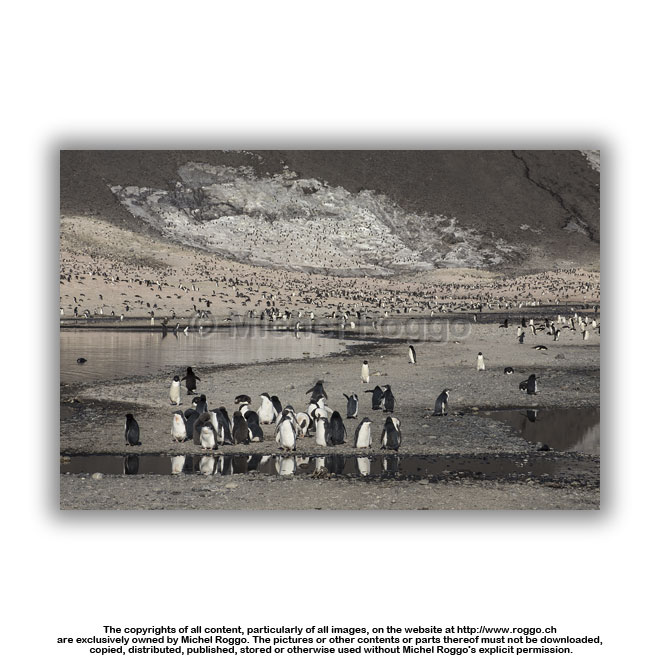 U40-776 Adélie penguin rookery U40-776 Adélie penguin rookerymeltwater pond, Cape Adare |
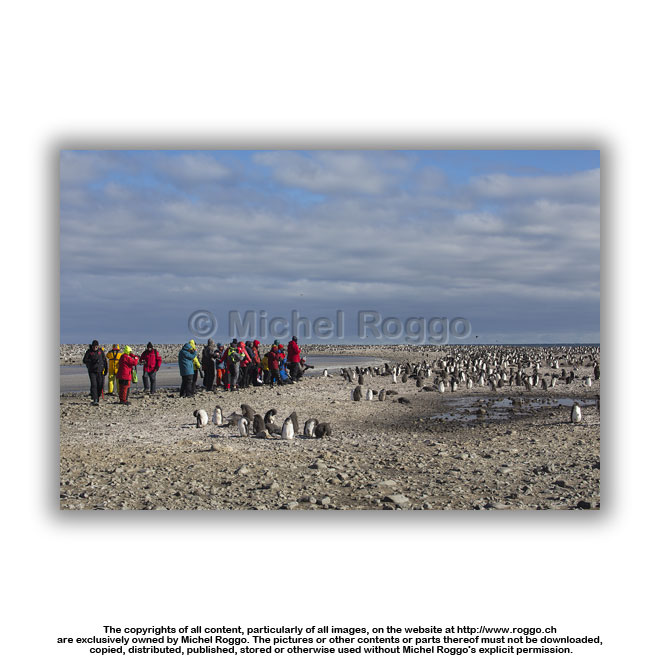
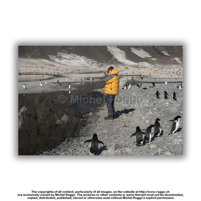 R-253 At Adélie penguin rookery R-253 At Adélie penguin rookeryCape Adare |
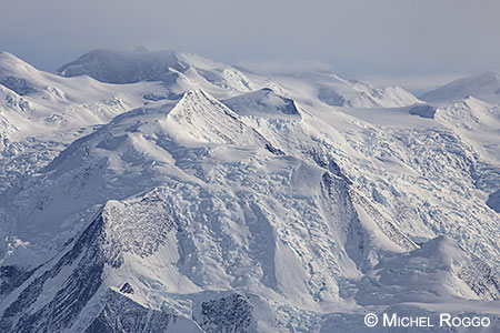
| Robertson Bay and Dugdale Glacier Landscapes | |||
 |
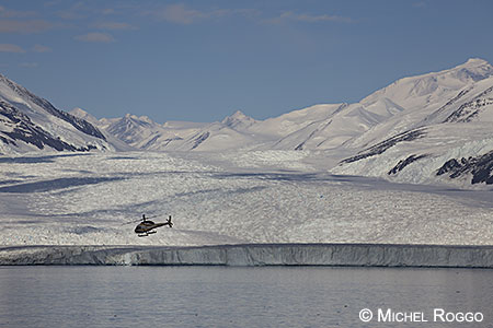 |
||
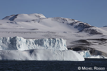
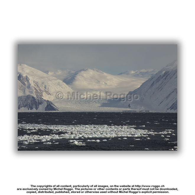
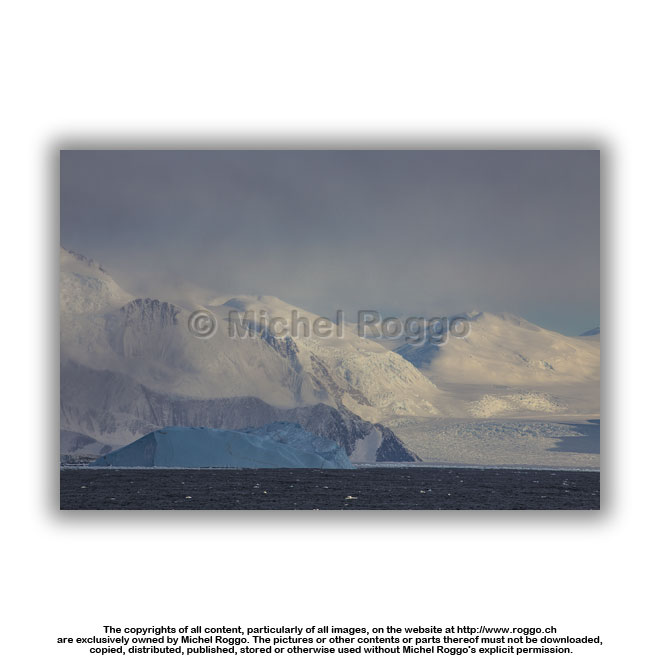
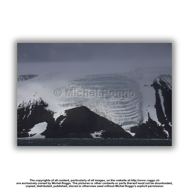
 U40-778 Glacier at Robertson Bay Ross Sea, North Victoria Land |
 U40-779 Glacier at Robertson Bay U40-779 Glacier at Robertson BayRoss Sea, North Victoria Land |
 U40-762 Sea ice Admiralty Mountains |
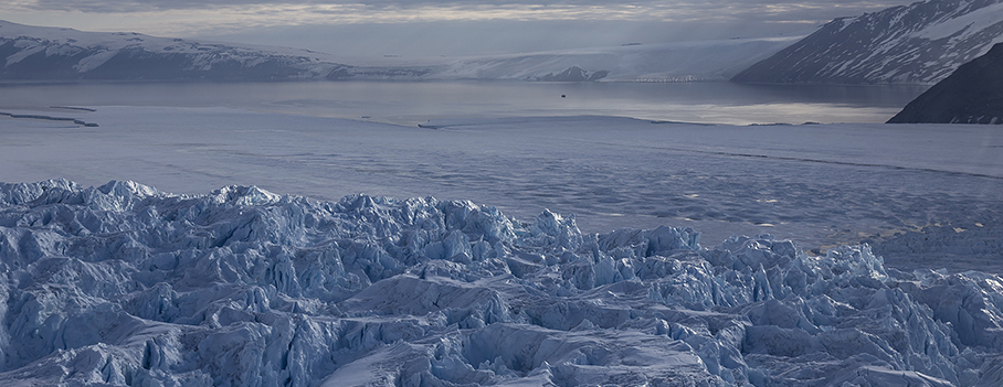
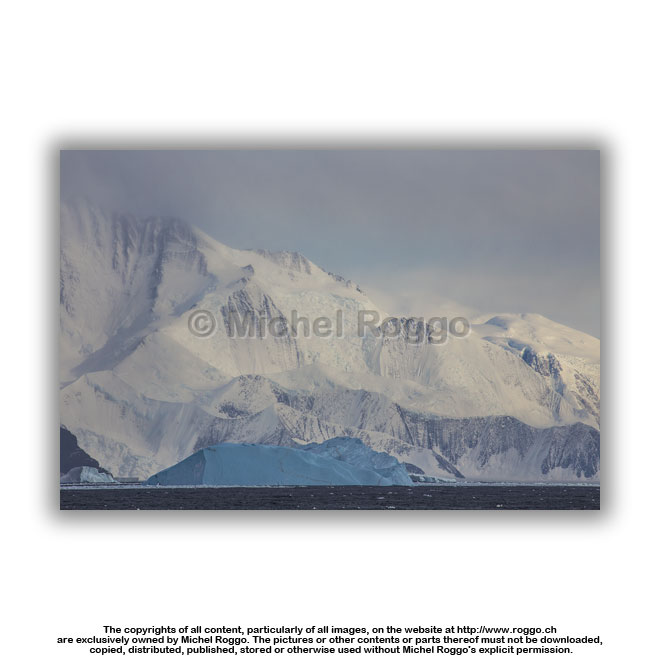
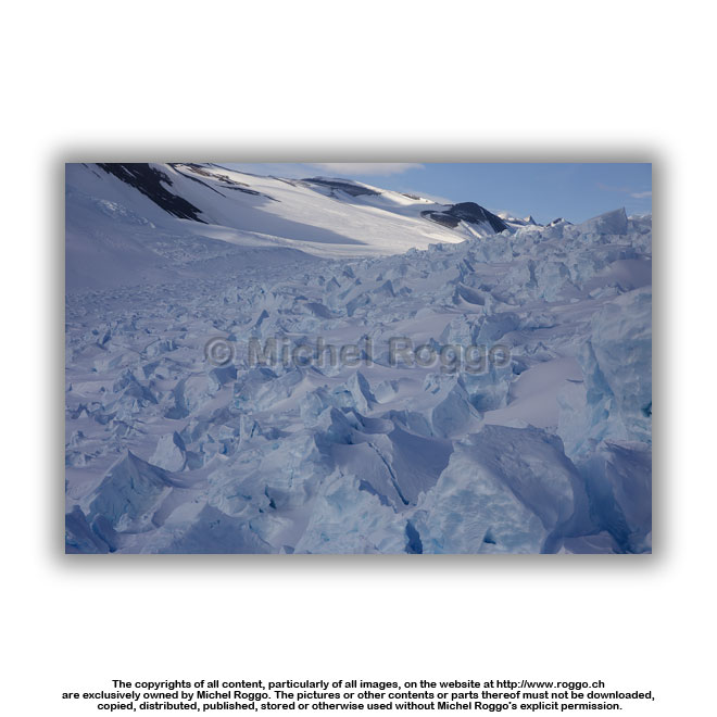
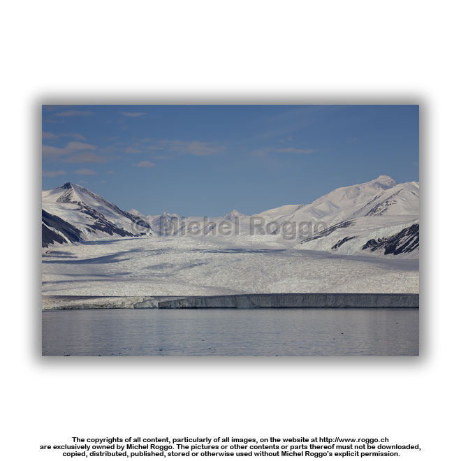 U40-781 Dugdale Glacier Admiralty Mountains, Robertson Bay |
 U40-782 Dugdale Glacier U40-782 Dugdale GlacierAdmiralty Mountains, Robertson Bay |
 U40-783 Dugdale Glacier Admiralty Mountains, Robertson Bay |
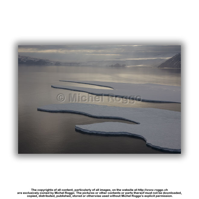
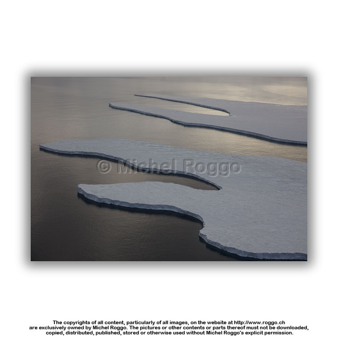
 U40-807 Iceberg at Robertson Bay Pennell Coast, Ross Sea |
 U40-808 Iceberg, Adélie penguin Robertson Bay, Ross Sea |
| Robertson Bay and Dugdale Glacier Aerials | |||
 |
 |
||
 |
 |
||
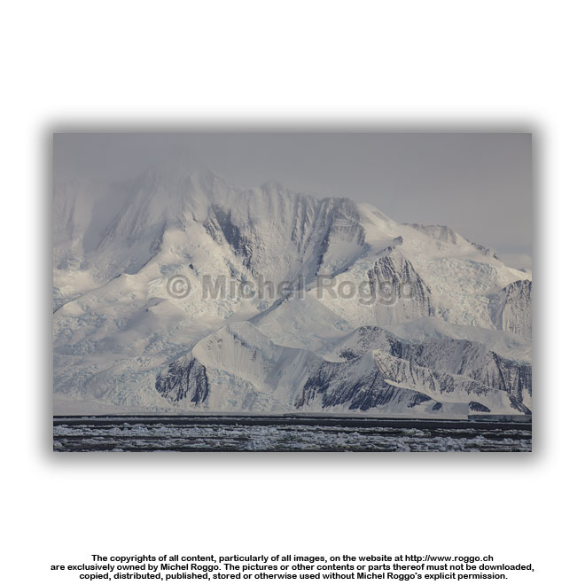
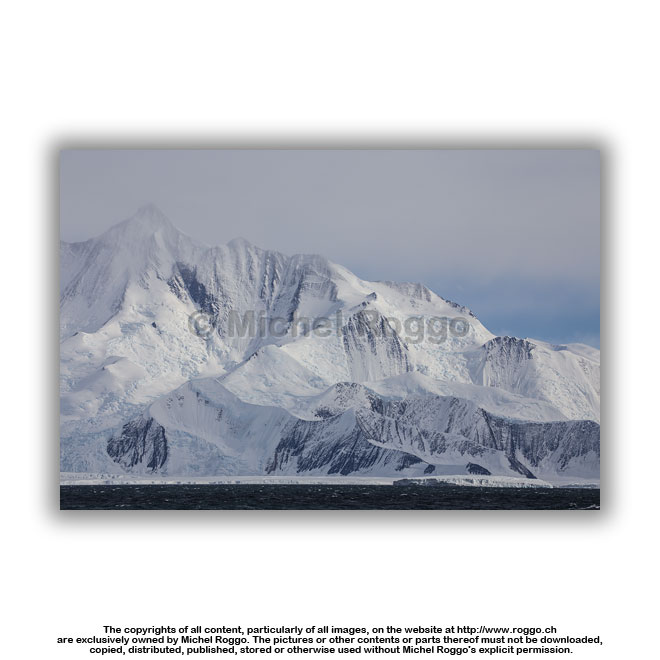
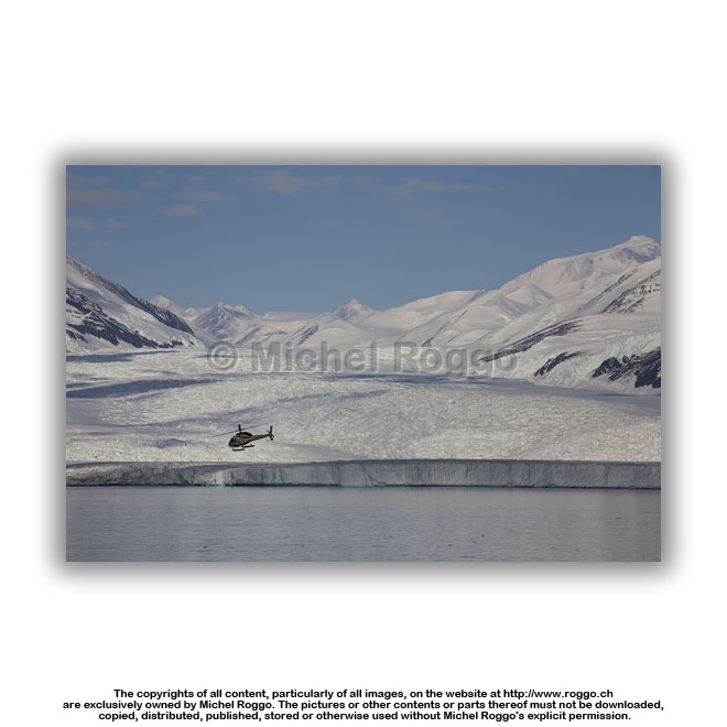
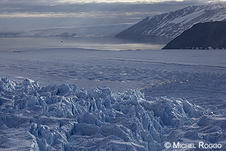
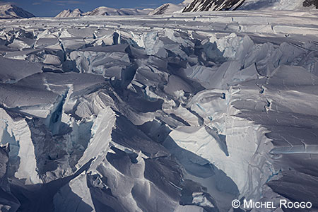
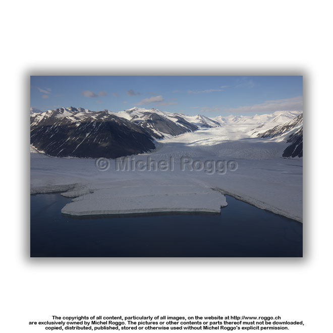
 U40-784 Dugdale Glacier U40-784 Dugdale GlacierAdmiralty Mountains, Robertson Bay |
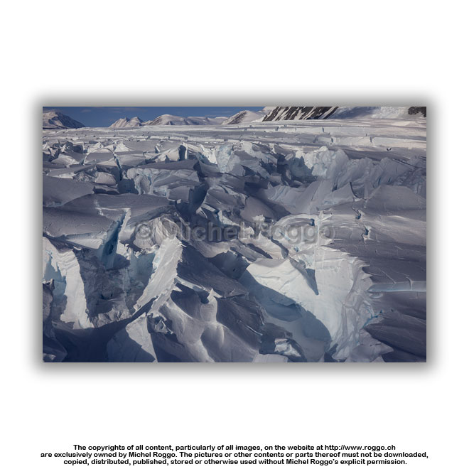 U40-786 Dugdale Glacier U40-786 Dugdale GlacierAdmiralty Mountains, Robertson Bay |
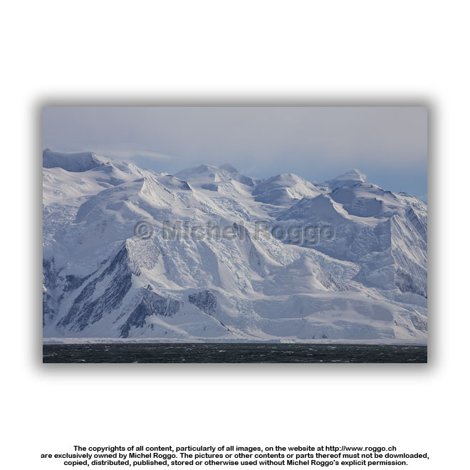
 U40-787 Dugdale Glacier Admiralty Mountains, Robertson Bay |
 U40-788 Dugdale Glacier Admiralty Mountains, Robertson Bay |
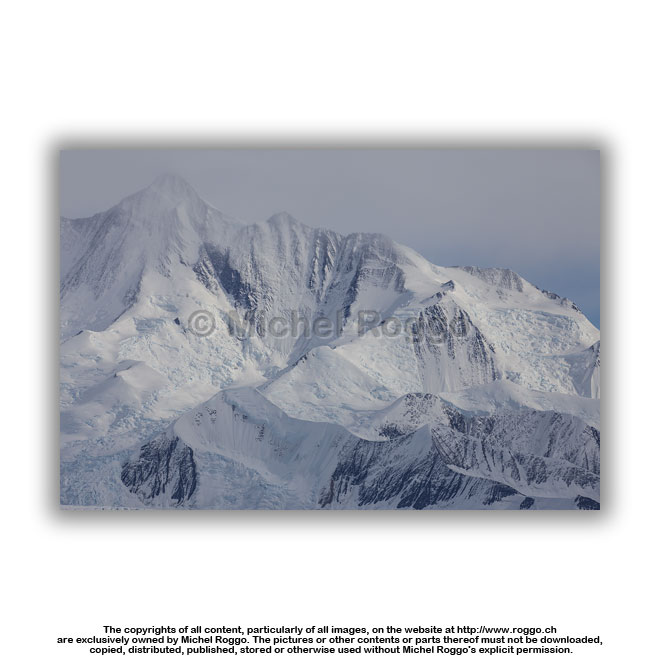
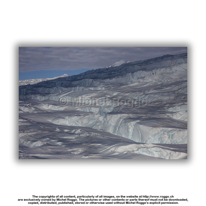
 U40-789 Dugdale Glacier U40-789 Dugdale GlacierAdmiralty Mountains, Robertson Bay |
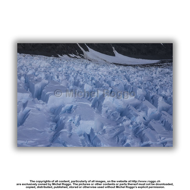 U40-790 Dugdale Glacier Admiralty Mountains, Robertson Bay |
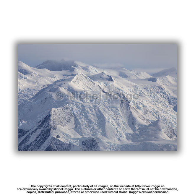
 U40-791 Dugdale Glacier Admiralty Mountains, Robertson Bay |
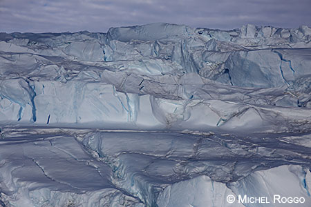
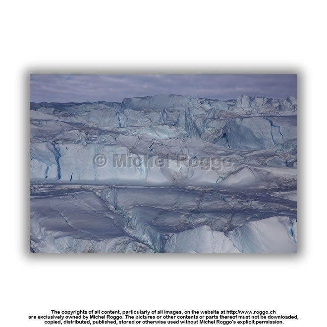
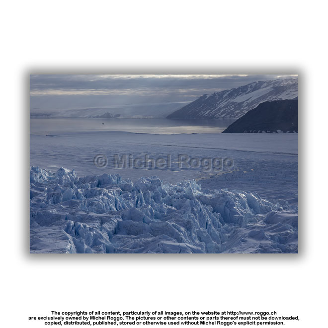 U40-792 Dugdale Glacier U40-792 Dugdale Glacierwith meltwater, Robertson Bay |
 U40-793 Dugdale Glacier with meltwater, Robertson Bay |
 U40-794 Dugdale Glacier with meltwater, Robertson Bay |
 U40-795 Dugdale Glacier U40-795 Dugdale Glacierwith meltwater, Robertson Bay |
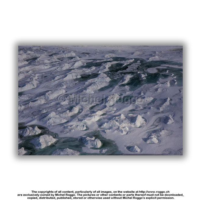 U40-796 Dugdale Glacier with meltwater, Robertson Bay |
 |
 |
||
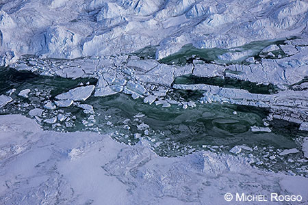
 U40-797 Dugdale Glacier with meltwater, Robertson Bay |
 U40-798 Dugdale Glacier Admiralty Mountains, Robertson Bay |
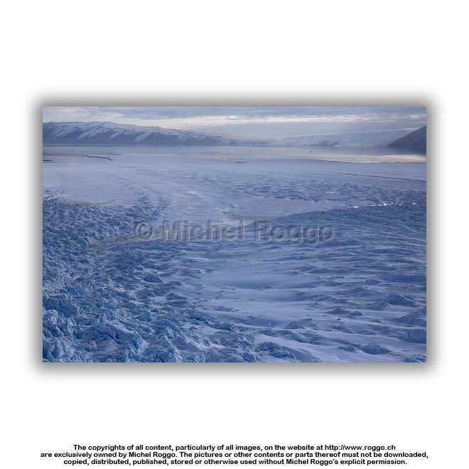
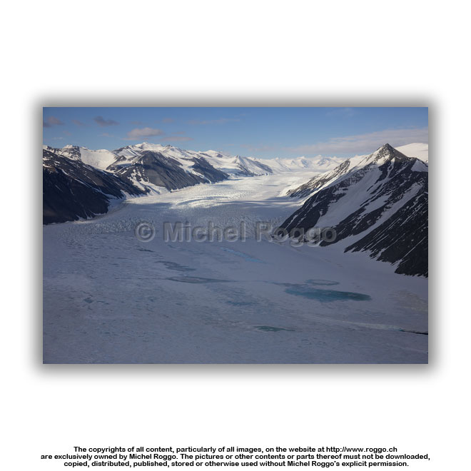 U40-800 Dugdale Glacier with meltwater, Robertson Bay |
 U40-801 Dugdale Glacier U40-801 Dugdale Glacierwith meltwater, Robertson Bay |
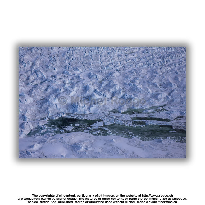
 U40-802 Dugdale Glacier Admiralty Mountains, Robertson Bay |
 U40-803 Dugdale Glacier U40-803 Dugdale GlacierAdmiralty Mountains, Robertson Bay |
 U40-804 Dugdale Glacier Admiralty Mountains, Robertson Bay |
 U40-806 Dugdale Glacier U40-806 Dugdale Glacierwith meltwater, Robertson Bay |
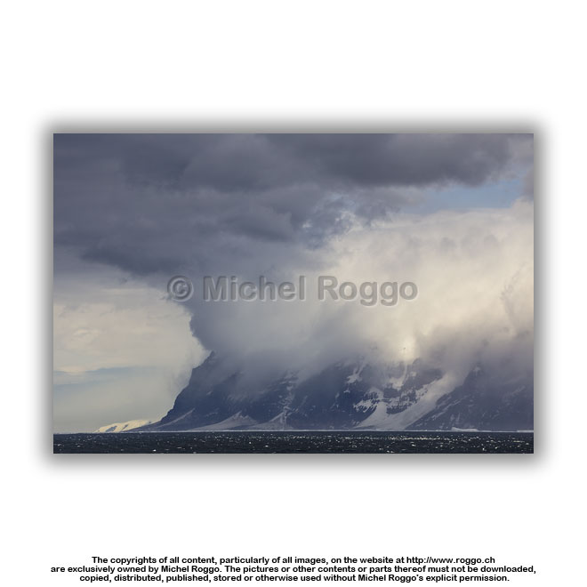
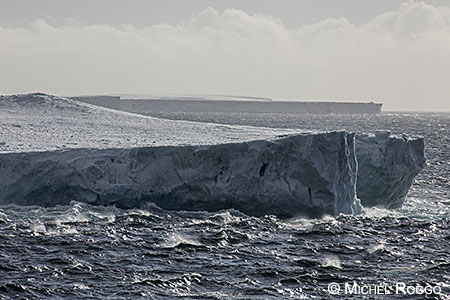
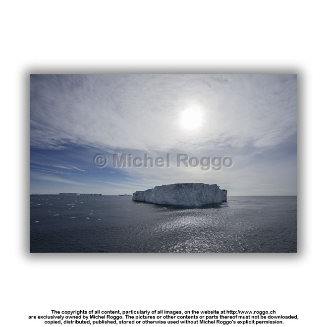
| Ross Sea | |||
 |
 |
||
 |
 |
||
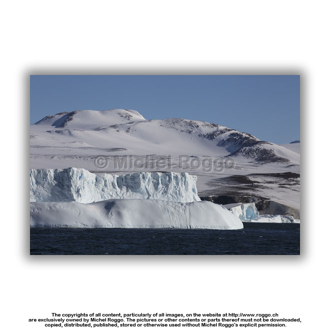
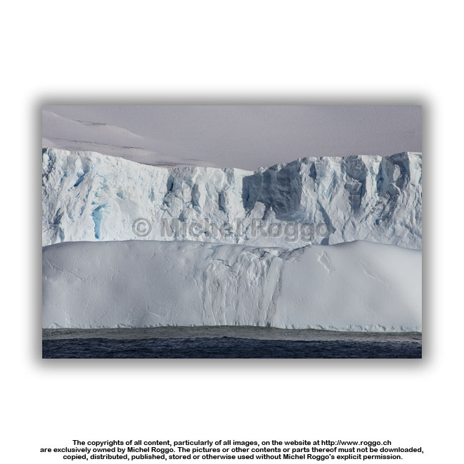
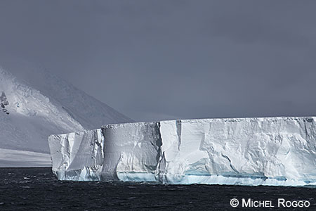
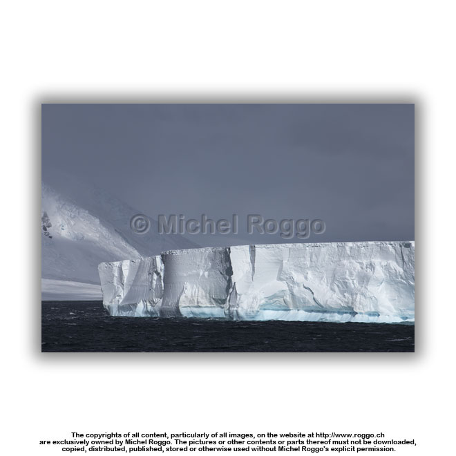
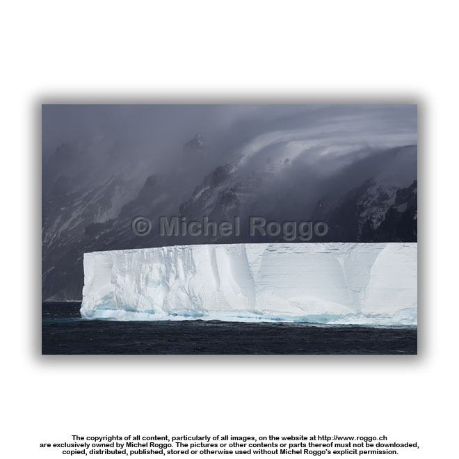
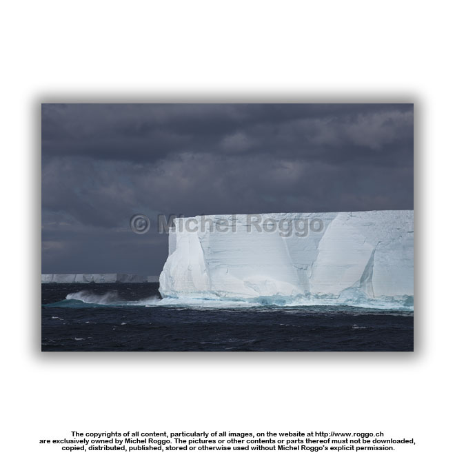
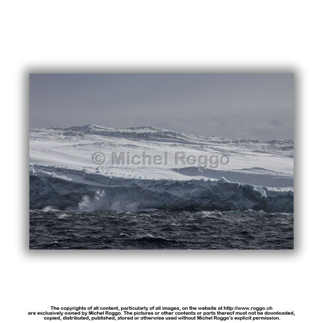
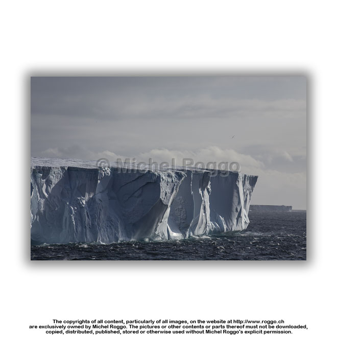
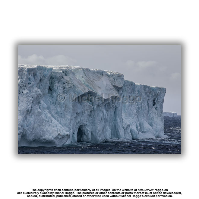
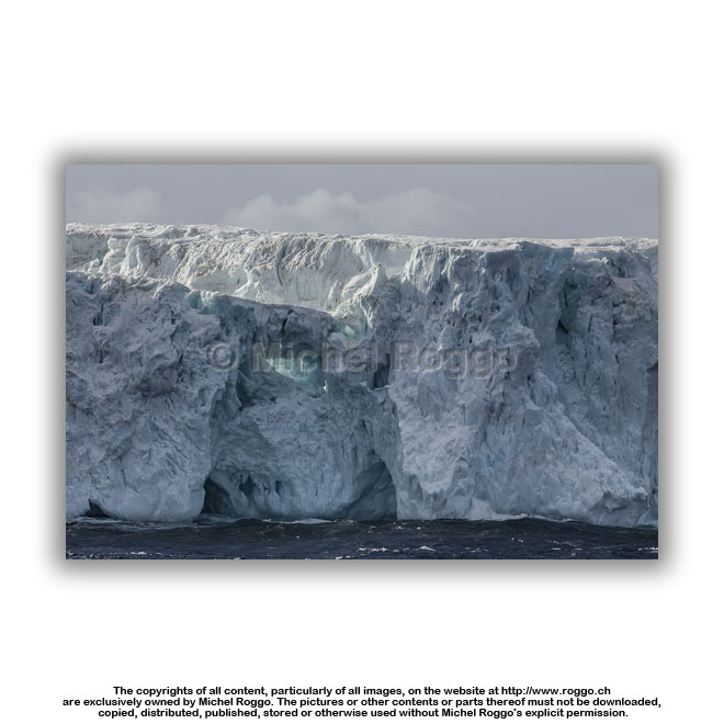
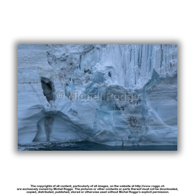
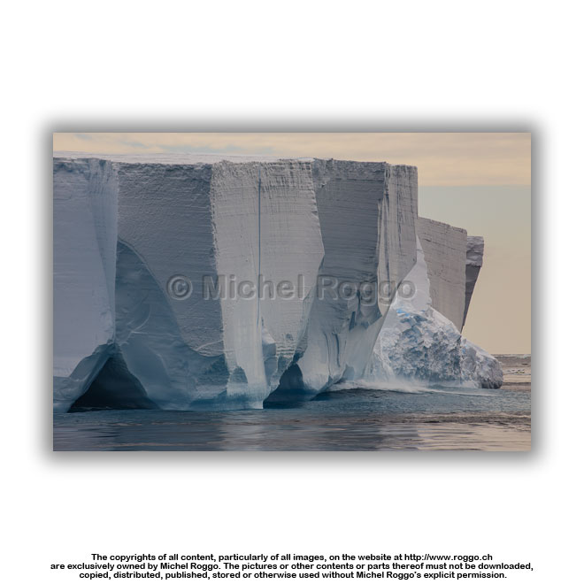
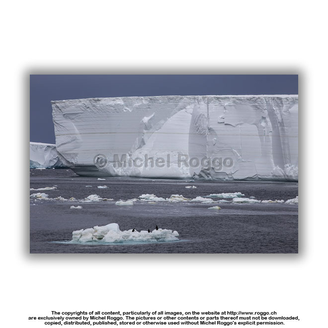
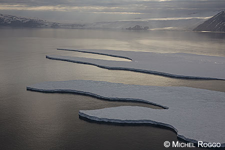
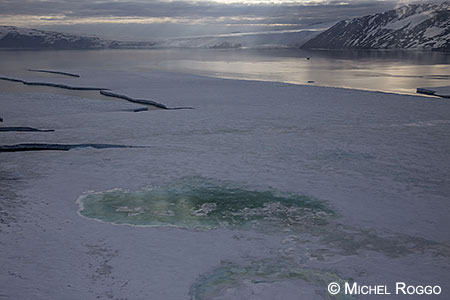
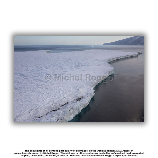
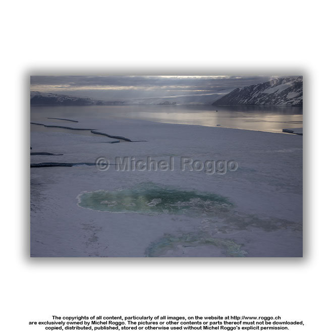
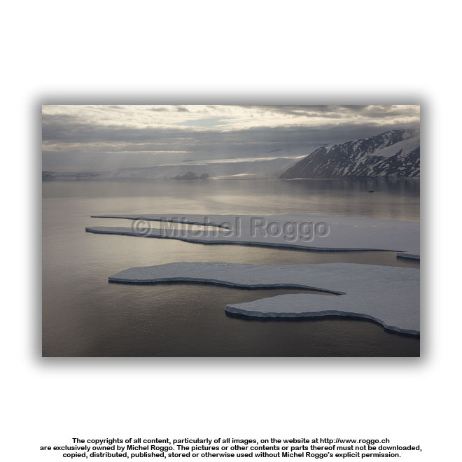
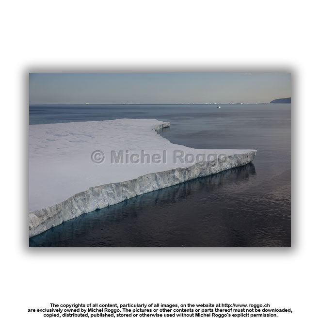
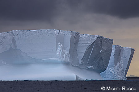
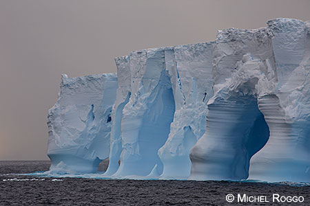
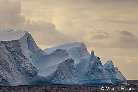
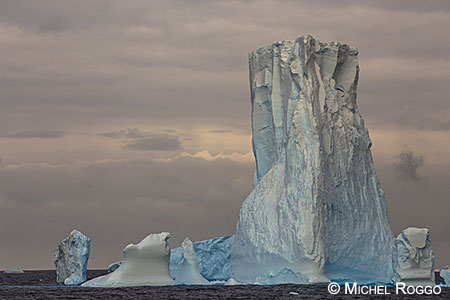
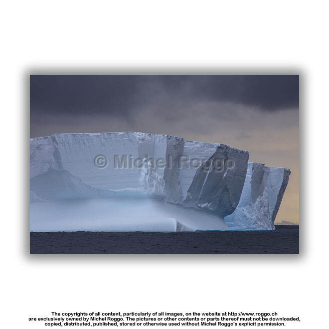 U40-809 Iceberg, eroded by waves U40-809 Iceberg, eroded by wavesRoss Sea |
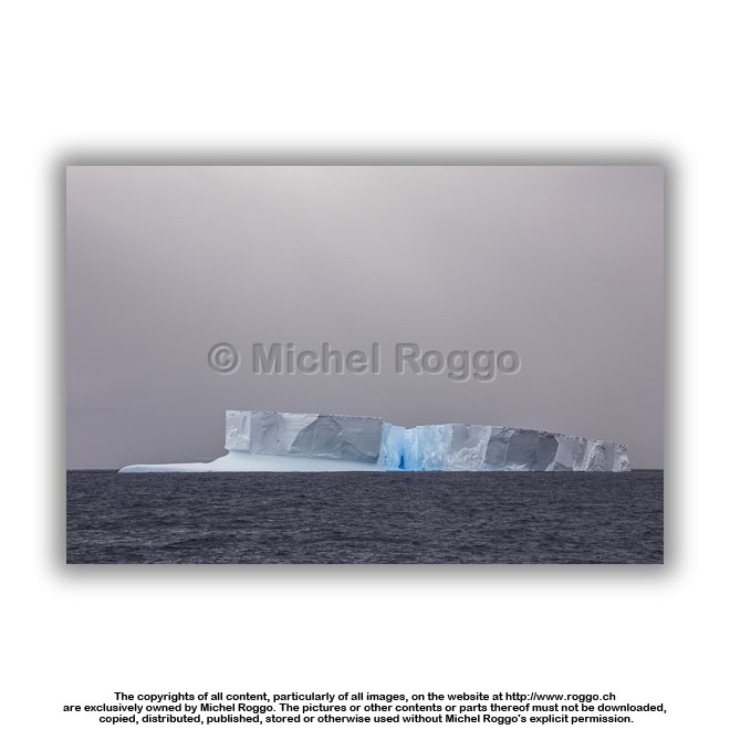 U40-810 Iceberg, eroded by waves U40-810 Iceberg, eroded by wavesRoss Sea |
 U40-811 Iceberg, eroded by waves Ross Sea |
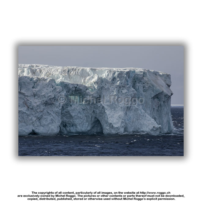
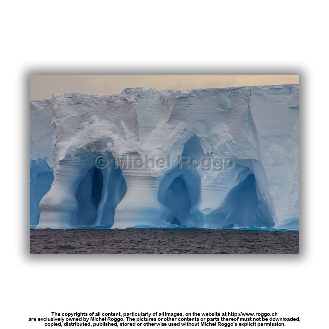 U40-813 Iceberg, eroded by waves Ross Sea |
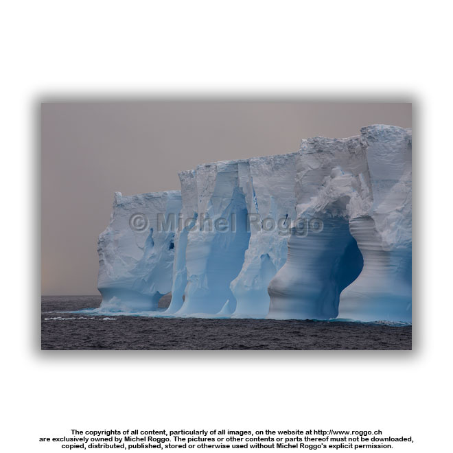 U40-814 Iceberg, eroded by waves U40-814 Iceberg, eroded by wavesRoss Sea |
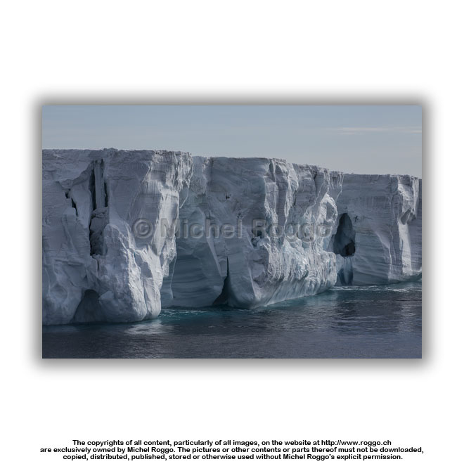
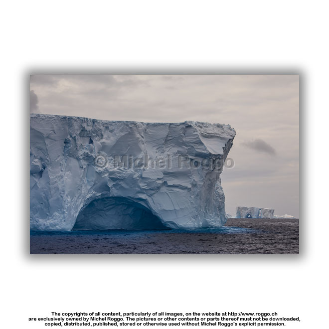 U40-816 Iceberg, eroded by waves U40-816 Iceberg, eroded by wavesRoss Sea |
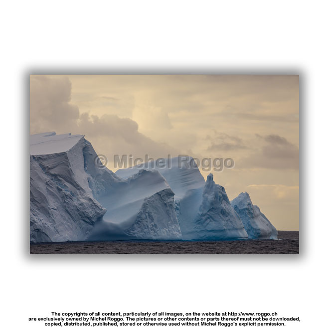 U40-817 Iceberg, eroded by waves U40-817 Iceberg, eroded by wavesRoss Sea |
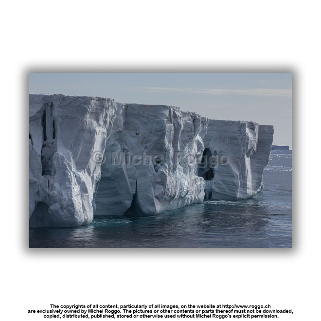
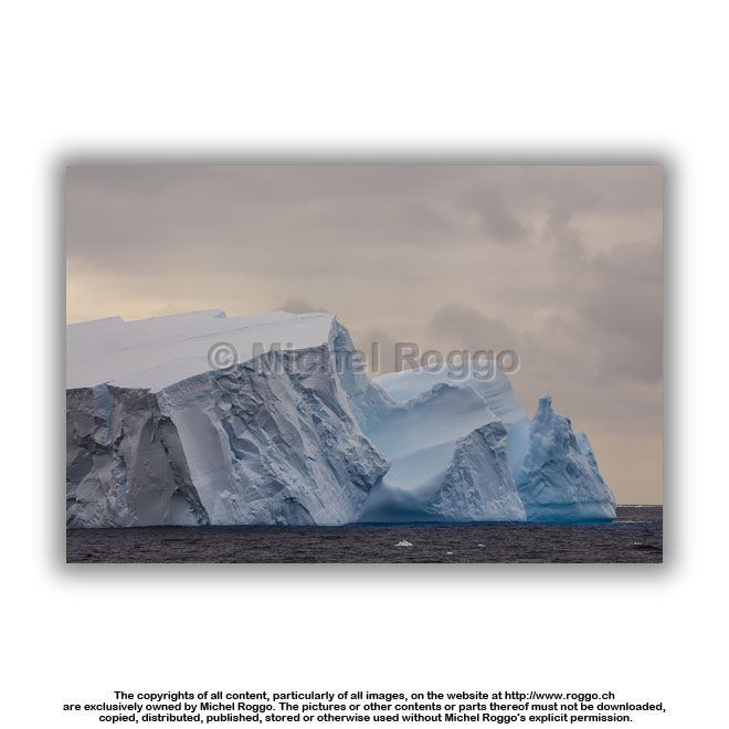 U40-818 Iceberg, eroded by waves Ross Sea |
 U40-820 Iceberg, eroded by waves U40-820 Iceberg, eroded by wavesRoss Sea |
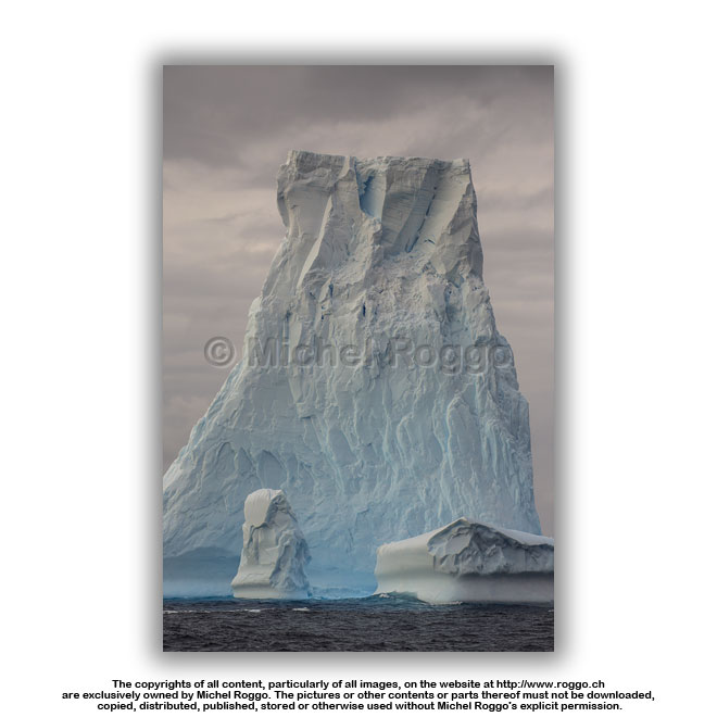 U40-822 Iceberg, eroded by waves Ross Sea |
 U40-823 Iceberg, eroded by waves Ross Sea |
 U40-821 Iceberg, eroded by waves Ross Sea |

| Website Michel Roggo | Copyrights of all images, movies and other contents 2021 © Michel Roggo | The Freshwater Project Website | |